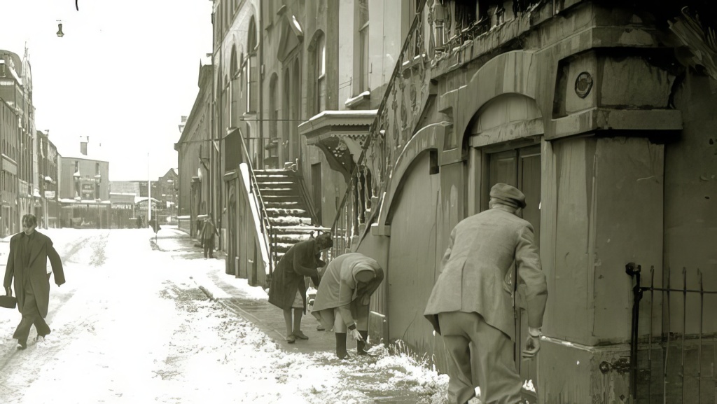
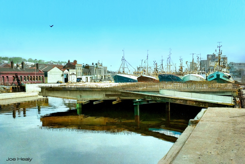
It’s still easy to see that Clontarf Bridge and Brian Boru Bridge were able to be lifted to allow maritime traffic to pass underneath. According to this post on Facebook by Patrick O’Donovan, they were locked in place in 1979. A comment on there says the last time Brian Boru Bridge was lifted was 1963.


He found these photos in a 1912 issue of a magazine called Engineer which I found on archive.org and you can read yourself. As well as those photos, that issue informed the reader about the railways converging in Cork City at the time:
On the first of the month a railway line connecting the Cork and Bandon terminus and the Great Southern Station in the city of Cork was opened for traffic. There are five different railway companies
running into Cork. The Great Southern and Western comes from Dublin and goes east to Queenstown; the Cork and Muskerry enters from the north-west; the the Macroom Company ran into the BandonCork and Macroom from the west; the Cork, Bandon and South Coast from the south-west; the Cork, Blackrock and Passage from the south-east. Each of these lines has its own terminus, but with the exception of the Macroom and Bandon lines, which up till 1878 used the same station, there has never till now been rail communication between any of them. This lack of physical connection has led to a great deal of inconvenience and delay, as well as to expense owing to the cost of transhipment. This was especially so in the case of the two lines which have now been brought into touch with one another by the new connecting link. The line crosses the two channels of the river Lee by means of two electrically operated lifting bridges, and advantage was taken while the work was in progress to give railway connections to the various riverside quays, which have now in all cases but one been joined to the new line.The line, for the most part, runs through the streets, but a level crossing over the Cork and Bandon Railway has been replaced by a steel overbridge.
The new road will certainly add greatly to the railway facilities of Cork, and the usefulness of the lines it joins should be much enhanced.
On page 32 of the Engineer issue linked above, you’ll find an article describing the building of the Cork City railways connecting Cork and Bandon terminus and the Great Southern station. Here’s part of it.
CORK CITY RAILWAYS.
THERE are five different railway companies running into Cork. The Great Southern and Western comes from Dublin, on the north and goes east to Queenstown.
The Cork and Muskerry enters from the north-west, the Cork and Macroom from the west, the Cork, Bandon and South Coast from the south-west, and the Cork, Blackrock and Passage from the south-east.
Each of these has its own terminus and none has had rail communication with another; the nearest to this being that the Cork and Bandon and Cork and Passage stations come together near the Albert Quay with only Albert-street between them. At one time the Macroom Company ran into the Bandon station, but it has had a terminus of its own since 1878. The Muskerry and Blackrock lines are 3ft. gauge.The most important of these systems is, of course, the Great Southern, whose terminus is on the north-east side of the city, in the residential portion and away from the business centre. The next in importance is the Cork and Bandon, which, with its neighbour, the Blackrock and Passage, is in the south-east and away from the business centre also. But while little over a quarter of a mile separate the Great Southern from the Cork and Bandon, both channels of the river Lee intervene, and it has been necessary to go through the city and over the St. Patrick and Parnell bridges.
The Cork and Bandon plays a very prominent part in the welfare of the south-western corner of Ireland. It is over 90 miles in length and of the standard Irish gauge, 5ft. 3in. Its usefulness has, however, been handicapped by the want of a physical connection with the Great Southern, whereby fish and early vegetables may more readily reach the markets by avoiding the delay and expense of transhipment Such a connection was strongly recommended by the Allport Royal Commission of 1885 on Irish Public Works.
It is, then, with no little satisfaction that we are able to announce that a connecting line between the Cork and Bandon terminus and the Great Southern station has been constructed and the new line was
opened on January 1st. Access is also being given by rail to the quays on both sides of each channel which will greatly assist the shipping facilities of the port.Powers to construct the Cork City Railways were given under an Act obtained in 1906, wherein the Treasury was authorised to advance £25,000 towards the cost. The Act contains the unusual clause—section 7— granting power to construct and maintain railways and sidings along, across, and on the level of any existing road, quay, or any new road. And in consequence of these powers, the Board of Trade was, under section 8, authorised to regulate the working of the traffic and the speed of the trains over the railways or sidings where laid along or across or on the level of the street.
The consent of the city authorities had, of course, to be obtained before the railway was allowed to go along the streets, and this consent has, apparently, been bought at a great price. The new railway passes by bridges over both channels of the Lee, and each
bridge has a carriage-way and two footpaths, all free of toll, besides the railway. The openings that had to be made elsewhere for the railway have also had to be made sufficiently wide for a carriage-way and two footpaths. This has therefore provided three new streets, 60ft. wide, which will afford much quicker communication between the north and south sides of the Lee, and to and from the promontory between the two channels on which the Customs House stands.
In passing it may be remarked that the trains will be worked by steam, and that the speed limit laid down by the Board of Trade is five miles an hour.The accompanying map, Fig. 1, illustrates the situation. The line commences at a point about the middle of the yard of the Cork and Bandon station B—C is the Cork, Blackrock and Passage station—and proceeds by the side of the engine-shed—a corner of which has had to be cut away—down a private road belonging to the company between the station and Eglinton Street and crosses Albert Quay, D, where it intercepts a double line of tramway. The Southern Channel is then crossed, and Lapp’s Quay, E, is reached. Thence across Lower George-street, to Anderson’s Quay, F, a distance of about 160 yards, is traversed by a new street, at the end of which is the Northern Channel, on the northern side of which comes St. Patrick’s Quay, G, where another new street, 70 yards long, has been made which leads into King-street and opposite Summer Hill, where is the residential part of the city. The construction of this last new street was not an essential part of the work, as the railway does not pass along it, but turns to the north-east and along a private right-of-way and out again near where King-street divides into Lower Glanmire-road —where is the Great Southern station, A—and Alfred-Street. The line passes along the latter and into the Great Southern yard near the goods shed, part of which has had to be removed to accommodate the new lines. At each end of the private right-of-way gates have been erected with red targets on each side.
It may also be noted that, as possibly another item in the price for the concession, a level crossing over the Cork and Bandon lines near the gasworks has been replaced by a steel overbridge, with long approaches on brick arches. This particular work was done by the Cleveland Bridge and Engineering Company, Limited.
Next to the fact that the trains will run through the streets, the most interesting feature is the spanning of the two channels of the river Lee. This is done by rolling-lift bridges, designed and constructed by Sir William Arrol and Co., Limited. Although the openings differ in width, the northern being 232ft. lin. between the quay walls, and the southern 196ft. 10in., the opening span of each bridge is 62ft. clear and the width 48ft. between the parapets. A third interesting feature is that the bridges are practically identical in construction. The engravings on page 42 show the two bridges almost completed. The upper view is that across the Northern Channel and the lower that over the Southern Channel. On the left in the former is St. Patrick’s Quay and on the right in the latter is Albert Quay, where is the Cork and Bandon station.
We are indebted to Sir William Arrol and Co., Limited —whose representative at Cork has been Mr. William Burnside, A.M. Inst. C.E.—for the photographs from which the accompanying engravings of the bridge have been prepared and to Crompton and Co., Limited, for those of the electrical machinery.
The railways have been laid by William Muirhead and Co., Limited, and the whole work has been supervised, on behalf of the Cork City Railways Company, by Mr. W. Y. Armstrong, M. Inst. C.E.
— From page 32 of The Engineer January-June 1912.


